
The Barn At Goosetree Farm - Guidebook
Sightseeing
Lovely town, nice little restaurants and shops. Home to the magnificent Buxton Opera House.
221 habitants recommandent
Buxton
Lovely town, nice little restaurants and shops. Home to the magnificent Buxton Opera House.
Lovely town with lots of shops and little restaurants. Home to the original Bakewell Pudding Shop.
375 habitants recommandent
Bakewell
Lovely town with lots of shops and little restaurants. Home to the original Bakewell Pudding Shop.
Magnificent stately home, gardens and shops together with Farm Shop.
43 habitants recommandent
Chatsworth
Magnificent stately home, gardens and shops together with Farm Shop.
Beautiful village with shops and nice pubs. Home to many Blue John caverns and Winnats Pass.
186 habitants recommandent
Castleton
Beautiful village with shops and nice pubs. Home to many Blue John caverns and Winnats Pass.
Only a short walk from the cottage, you will find Lud's Church hidden in Gradbach Forest.
25 habitants recommandent
Lud's Church
Only a short walk from the cottage, you will find Lud's Church hidden in Gradbach Forest.
Where Cheshire, Derbyshire and Staffordshire meet. A local beauty spot and only a few miles walk from the cottage.
25 habitants recommandent
Three Shires Heads
Where Cheshire, Derbyshire and Staffordshire meet. A local beauty spot and only a few miles walk from the cottage.
Known locally as the Matterhorn of Cheshire, it is a distinctive landmark throughout much of the east of the county. Views from the top are spectacular.
11 habitants recommandent
Shutlingsloe
Known locally as the Matterhorn of Cheshire, it is a distinctive landmark throughout much of the east of the county. Views from the top are spectacular.
The Roaches where Buzzards fly and Wallabies still roam. The Roaches (or Roches) is a wind-carved outcrop of gritstone rocks straddling the parishes of Leekfrith and Heathylee in the Peak District National Park about 4 miles north of Leek, Staffordshire and 8 miles south of Buxton, Derbyshire.
The name Roaches has evolved recently from 'Roches' as the area used to be known only 100 years (or less) ago. 'Roches' is the french word for rocks.
To get to the Roaches take the A53 road from Leek, Staffordshire towards Buxton. After about 4 miles and about half a mile past the Three Horseshoes pub take a left turn signposted Upper Hulme. After a hundred metres take the left fork. Follow this road for about one and a half miles. Park in the lay-byes - you cannot miss the Roaches! Using Satnav use postcode ST13 8UB. To avoid a ticket make sure you park as signed!
The only two centres of a sparse population are the Villages of Meerbrook and Upper Hulme. Facilities include a tea room, a village hall, furniture maker, vehicle repair and a visitor centre.
The Roaches are particularly popular with climbers because of the diversity of the climbing routes there. Also there are many miles of paths to satisfy the most seasoned rambler.
The Roaches area includes Hen Cloud, so named because with a little imagination it looks like a roosting hen. The name could also have been derived from the Anglo -Saxon 'Henge Clud' meaning steep cliff. Also Ramshaw Rocks which includes the weird rock formation called the Winking Man.
For many years, from the 1930's to the early 2000s, a fairly large group of Wallabies roamed the Roaches. It is believed that there is only one left now. They had been released from a private zoo. 3 Yaks were also released at the same time but they died out in the 1950's.
90 habitants recommandent
The Roaches
The Roaches where Buzzards fly and Wallabies still roam. The Roaches (or Roches) is a wind-carved outcrop of gritstone rocks straddling the parishes of Leekfrith and Heathylee in the Peak District National Park about 4 miles north of Leek, Staffordshire and 8 miles south of Buxton, Derbyshire.
The name Roaches has evolved recently from 'Roches' as the area used to be known only 100 years (or less) ago. 'Roches' is the french word for rocks.
To get to the Roaches take the A53 road from Leek, Staffordshire towards Buxton. After about 4 miles and about half a mile past the Three Horseshoes pub take a left turn signposted Upper Hulme. After a hundred metres take the left fork. Follow this road for about one and a half miles. Park in the lay-byes - you cannot miss the Roaches! Using Satnav use postcode ST13 8UB. To avoid a ticket make sure you park as signed!
The only two centres of a sparse population are the Villages of Meerbrook and Upper Hulme. Facilities include a tea room, a village hall, furniture maker, vehicle repair and a visitor centre.
The Roaches are particularly popular with climbers because of the diversity of the climbing routes there. Also there are many miles of paths to satisfy the most seasoned rambler.
The Roaches area includes Hen Cloud, so named because with a little imagination it looks like a roosting hen. The name could also have been derived from the Anglo -Saxon 'Henge Clud' meaning steep cliff. Also Ramshaw Rocks which includes the weird rock formation called the Winking Man.
For many years, from the 1930's to the early 2000s, a fairly large group of Wallabies roamed the Roaches. It is believed that there is only one left now. They had been released from a private zoo. 3 Yaks were also released at the same time but they died out in the 1950's.
On the edge above Swythamley, in the Peak District National Park, there is a famous landmark known as the Hanging Stone. The Hanging Stone, a short distance from Lud's Church near Wincle, has spectacular moorland views across to the Roaches and Shutlingsloe as well as lush woodland and drystone-walled pastures.
The Hanging Stone bears two plaques. One to Colonel Brocklehurst, who was killed in Burma in 1942 and the other marking the grave of Burke, a bull mastiff and close companion to the Brocklehurst Family of Swythamley Hall. Burke died in 1874 and his epitaph reads:
“A noble mastiff, black and tan,
Faithfull as woman, braver than man.
A gun and a ramble his heart’s desire
With the friend of his life the Swythamley Squire.”
Hanging Stone
On the edge above Swythamley, in the Peak District National Park, there is a famous landmark known as the Hanging Stone. The Hanging Stone, a short distance from Lud's Church near Wincle, has spectacular moorland views across to the Roaches and Shutlingsloe as well as lush woodland and drystone-walled pastures.
The Hanging Stone bears two plaques. One to Colonel Brocklehurst, who was killed in Burma in 1942 and the other marking the grave of Burke, a bull mastiff and close companion to the Brocklehurst Family of Swythamley Hall. Burke died in 1874 and his epitaph reads:
“A noble mastiff, black and tan,
Faithfull as woman, braver than man.
A gun and a ramble his heart’s desire
With the friend of his life the Swythamley Squire.”
With its winding cobbled streets, welcoming Market Place and handsome Tudor and Georgian heritage, picturesque Ashbourne is known as 'The Gateway to Dovedale'.
While there's no doubt that it's the perfect base if you want to explore the spectacular limestone landscapes of the southern White Peak, it also pays to take a leisurely walking tour around town to immerse yourself in its fascinating history and architecture.
148 habitants recommandent
Ashbourne
With its winding cobbled streets, welcoming Market Place and handsome Tudor and Georgian heritage, picturesque Ashbourne is known as 'The Gateway to Dovedale'.
While there's no doubt that it's the perfect base if you want to explore the spectacular limestone landscapes of the southern White Peak, it also pays to take a leisurely walking tour around town to immerse yourself in its fascinating history and architecture.
Picturesque, popular walk through pastures & a limestone valley to stepping stones across a river.
26 habitants recommandent
Les pierres de Dovedale Stepping
Picturesque, popular walk through pastures & a limestone valley to stepping stones across a river.
Neighbourhoods
Wildboarclough is a village in east Cheshire, England, in the civil parish of Macclesfield Forest and Wildboarclough within the Peak District National Park.
Wildboarclough
Wildboarclough is a village in east Cheshire, England, in the civil parish of Macclesfield Forest and Wildboarclough within the Peak District National Park.
Wincle and its neighbour Danebridge together form one of Macclesfield Borough's most picturesque settlements, straddling either side of the River Dane where it separates Cheshire from Staffordshire. Wincle is geographically centred around the attractive St Michael's Church and adjacent village school, with spectacular moorland views across to the Roaches, Shutlingsloe and Hanging Stone as well as lush woodland and drystone-walled pastures. Such rich scenery and well-known pubs for eating and drinking, makes Wincle a favourite place for walkers and other visitors.
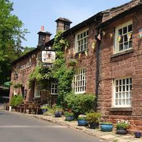
Wincle
Wincle and its neighbour Danebridge together form one of Macclesfield Borough's most picturesque settlements, straddling either side of the River Dane where it separates Cheshire from Staffordshire. Wincle is geographically centred around the attractive St Michael's Church and adjacent village school, with spectacular moorland views across to the Roaches, Shutlingsloe and Hanging Stone as well as lush woodland and drystone-walled pastures. Such rich scenery and well-known pubs for eating and drinking, makes Wincle a favourite place for walkers and other visitors.